Leiden University
ArcGIS, QGIS or web apps can simply use this map with web map services. WMTS, TileJSON or XYZ tiles are provided for quick access to processed maps.
Sign in to get links.
Sign in to download GeoTIFF.
Overlay & compare
iiif viewer, iiif info json
Website
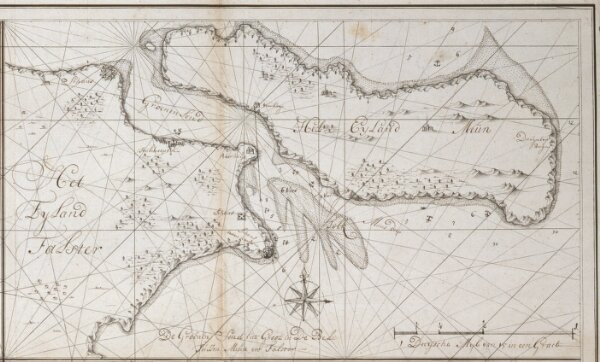
De Groenen Sond int groot in de Belt tussen Meun en Falster
COLLBN003-01-016_2
pilot
Denmark
1726
Johannes van Keulen